


Protection Township Voting District, Comanche County, Kansas
About
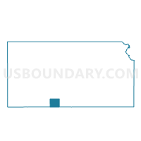
Outline

Summary
| Unique Area Identifier | 584316 |
| Name | Protection Township Voting District |
| County | Comanche County |
| State | Kansas |
| Area (square miles) | 173.52 |
| Land Area (square miles) | 173.03 |
| Water Area (square miles) | 0.49 |
| % of Land Area | 99.72 |
| % of Water Area | 0.28 |
| Latitude of the Internal Point | 37.16481960 |
| Longtitude of the Internal Point | -99.48711430 |
Maps


Graphs
Select a template below for downloading or customizing gragh for Protection Township Voting District, Comanche County, Kansas


Neighbors
Neighoring Voting District (by Name) Neighboring Voting District on the Map
- Voting District 303, Harper County, OK
- Voting District 8, Woods County, OK
- Avilla Township Voting District, Comanche County, KS
- Coldwater Township Voting District, Comanche County, KS
- Lexington Township Voting District, Clark County, KS
- Mullinville Voting District, Kiowa County, KS
- Sitka Township Voting District, Clark County, KS
Top 10 Neighboring County Subdivision (by Population) Neighboring County Subdivision on the Map
- Kiowa Rural township, Kiowa County, KS (2,553)
- Buffalo CCD, Harper County, OK (1,718)
- Coldwater township, Comanche County, KS (1,048)
- Protection township, Comanche County, KS (677)
- West Woods CCD, Woods County, OK (466)
- Avilla township, Comanche County, KS (84)
- Lexington township, Clark County, KS (78)
- Sitka township, Clark County, KS (63)
Top 10 Neighboring Place (by Population) Neighboring Place on the Map
Top 10 Neighboring Unified School District (by Population) Neighboring Unified School District on the Map
- Comanche County Unified School District 300, KS (1,926)
- Buffalo Public Schools, OK (1,694)
- Bucklin Unified School District 459, KS (1,371)
- Ashland Unified School District 220, KS (1,229)
- Freedom Public Schools, OK (527)
- Mullinville Unified School District 424, KS (427)
Top 10 Neighboring State Legislative District Lower Chamber (by Population) Neighboring State Legislative District Lower Chamber on the Map
- State House District 61, OK (34,098)
- State House District 58, OK (33,694)
- State House District 115, KS (21,825)
- State House District 116, KS (19,915)
Top 10 Neighboring State Legislative District Upper Chamber (by Population) Neighboring State Legislative District Upper Chamber on the Map
- State Senate District 27, OK (72,228)
- State Senate District 38, KS (70,617)
- State Senate District 33, KS (64,554)
Top 10 Neighboring 111th Congressional District (by Population) Neighboring 111th Congressional District on the Map
Top 10 Neighboring Census Tract (by Population) Neighboring Census Tract on the Map
- Census Tract 9542, Woods County, OK (4,175)
- Census Tract 9691, Kiowa County, KS (2,553)
- Census Tract 9671, Clark County, KS (2,215)
- Census Tract 9676, Comanche County, KS (1,891)
- Census Tract 9521, Harper County, OK (1,718)
Top 10 Neighboring 5-Digit ZIP Code Tabulation Area (by Population) Neighboring 5-Digit ZIP Code Tabulation Area on the Map
- 73834, OK (1,643)
- 67831, KS (1,117)
- 67029, KS (1,063)
- 67834, KS (964)
- 67127, KS (701)
- 73842, OK (494)
- 67109, KS (418)